$49,900
TBD Parcel # 201-34-002, Snowflake, AZ 85937
00 Needs Subdivision 00 · Navajo County
What's special
- Horses allowed
Description
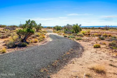
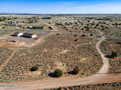
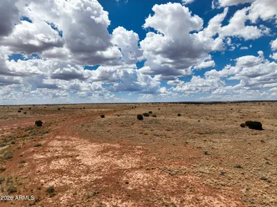
Ranch land that borders State Land to the West. Remote, private and peaceful. Located at an elevation of approx. 5600. See associated docs for location. GPS co-ordinates are: Latitude: 34.63543, Longitude: -110.50244. There is no sign on the property.
Property details
Exterior
Exterior and Lot Features
- Level
Land Info
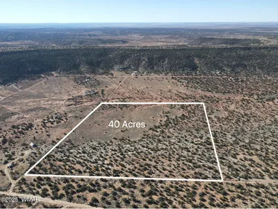
- Lot Size Acres: 80.00
- Lot Size Square Feet: 3,484,800
Home Features
- Horse Property: Yes
Community
Neighborhood
- Subdivision: 00 Needs Subdivision 00
- MLS Area: Snowflake
Listing
Other Property Info
- Annual Tax Amount: $138
- Source Listing Status: Active
- County: Navajo
- Directions: From State Highway 377 West on Ducklake Rd, approx. 6 miles to Coyote Trail - check associated documents and photos to see County Map. GPS co-ordinates are: included in the photos.
- Property Subtype: Agriculture
- Parcel Number: 201-34-002
- Postal City: Snowflake
- Listing Date: 3/26/2026
- On Market Date: 3/27/2026
- MLS#: 260258
Contact Us
Contact Us
Ask a question or schedule a showing
Listing updated: May 23, 2026
MLS#: 260258

Data relating to real estate for sale on this website comes in part from the Internet Data Exchange (IDX) program of White Mountain Association of REALTORS®. IDX information is provided exclusively for consumers' personal, non-commercial use, and may not be used for any purpose other than to identify prospective properties consumers may be interested in purchasing. The data is deemed reliable but is not guaranteed accurate by the MLS.
© 2026 White Mountain Association of REALTORS®. All rights reserved.
Similar homes in Snowflake
Land for sale
$49,9003.1 acres
1791 E Mountain View, Snowflake, AZ 85937
West USA Realty - Show Low
Land for sale
$49,9000.98 acres
2604 E 9th Sundown Lane 90, Snowflake, AZ 85937
HomeSmart
Land for sale
$49,90080 acres
TBD Parcel 201-34-002 002, Snowflake, AZ 85937
West USA Realty
Land for sale
$49,9000.33 acres
1667 W PRAIRIE Road, Snowflake, AZ 85937
Realty Executives Arizona Territory
Land for sale
$49,99940.39 acres
TBD Stirrup Road, Snowflake, AZ 85937
SEI Real Estate Professionals - Snowflake

Land for sale
$49,9995.5 acres
3977 Aztec Road, 3975, 3971, 3967, 3965, Snowflake, AZ 85937
Sundance Real Estate LLC